It’s also on the wrong side of the road !! ![]()
![]()
1 Like
If you have the same number of points for one path (or object) as another, you can easily animate the points from one to the other giving the impression of one object seamlessly morphing into the other . You can do this by starting with the more complicated in an SVG editor and then creating the other shape by moving the points (nodes) around. See here for how:
Yes, I use “animateMotion” for the little circles. They are shown in the table as unicode characters, but I only do that for the visual aspect (colour), when I put them in the animation I actually draw a <circle> and use <animateMotion> to cause it to move along the path. Rather than copy the points from the path I use ‘mpath’ to specify the path whose points I wish to use. It is similar to the way you can embed an image, or link (refer) to it. the command is:
<mpath xlink:href="#${id}"/> where id is the ID of the path. P.S. the first little circle is special - it takes on whatever colour the path is.
1 Like
LOL!
No, in England they drive on the left ![]()
Also in Cyprus. Many years ago a friend of mine went to Malta. When he returned he told me he’d hired a car and toured the island
“Oh” I said “that should have been quite easy, since they drive on the left in Malta”
He replied “It was a nightmare, the English drive there on the left, the continentals drive there on the right and the Maltese drive in the shade”.
2 Likes
I once went to Malta and drove around.
We drive on the left until the next crossroads
The windshield wipers are put on instead of the turn signals.
We drive on the right at the exit of the crossroads until a car comes in front of us.
It is the passenger who shifts gears, there is no lever on the right of the driver’s seat.
In short, we almost died several times 
[Edit] I forgot: If at the exit of a crossroads we are in front of a car with the windshield wipers on, we don’t say anything, he’s certainly as lost as we are.
1 Like
Looks to me like the little car’s driving upside down in the middle of the road … ![]()
One time I drove on the left side… Left highway instead of right highway. It was a long time ago, in another century. I was with friends and after the incident, we considered and adopted the “designated driver” rule on party nights.


1 Like
Hi @Elusien
Very clever concept, you however, made a mistake on the spelling on your website.
There is a mistake on the word… mistake 
By “design” perhaps? 
1 Like
By design of course , I always put 1 mstake on a webpage on purpose. It’s subliminal, and causes the reader to take in the content more readily as the brain is subconsciously scanning the text more thoroughly looking for further typographical errors. You will see that I am using this technique in the text I am writing here!
And if you believe that, you’ll believe anything. Thnk U four prof-reeding, the webpaige has bean dooly curekted.
1 Like

σας ευχαριστώ
How’s your Greek?
1 Like
Σας παρακαλούμε, almost as bad as my Slovakian/Slovovenian (reference to a different post I just made).
1 Like
C’mon, you gotta brush up on your Greek to really interact with the locals. 
Get one of those “Learn Greek in 21 years” type books.
Been to Cyprus several times, love it.
1 Like
This looks awesome. Your example Cyprus animation is great. Really well done on this tool.
Now I need a version that reads a GPX file to trace the route for me  I would use it to show progress on a hiking trail and put clips of that in between photos and videos of my slideshows.
Also I have never used a vector image editor so I might have to try Inkscape at some point.
You might be better using the technique described here:
1 Like
Great, thanks. Yeah sounds like Google Earth Pro or Google Earth Studio are the way to go for that. I have dabbled with tours in Google Earth Pro but need to learn more. And Studio may be the way to go now. I’ll have to dive in to it.
Please let us know how you get on. I can see this being a popular pastime for people recording their trips using GPS, Google Earth and Shotcut.
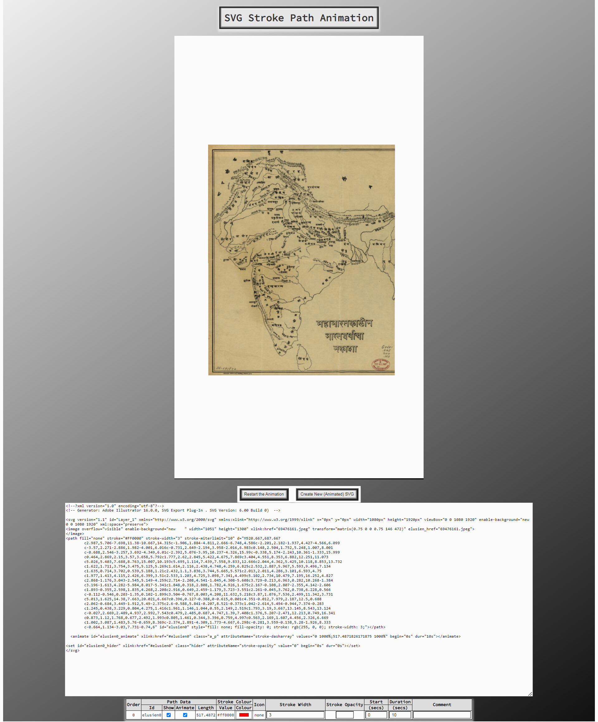
Unable to get this to work - used Illustrator to draw the line - svg upload isn’t permitted here in the forum.
Windows 7 - Chrome